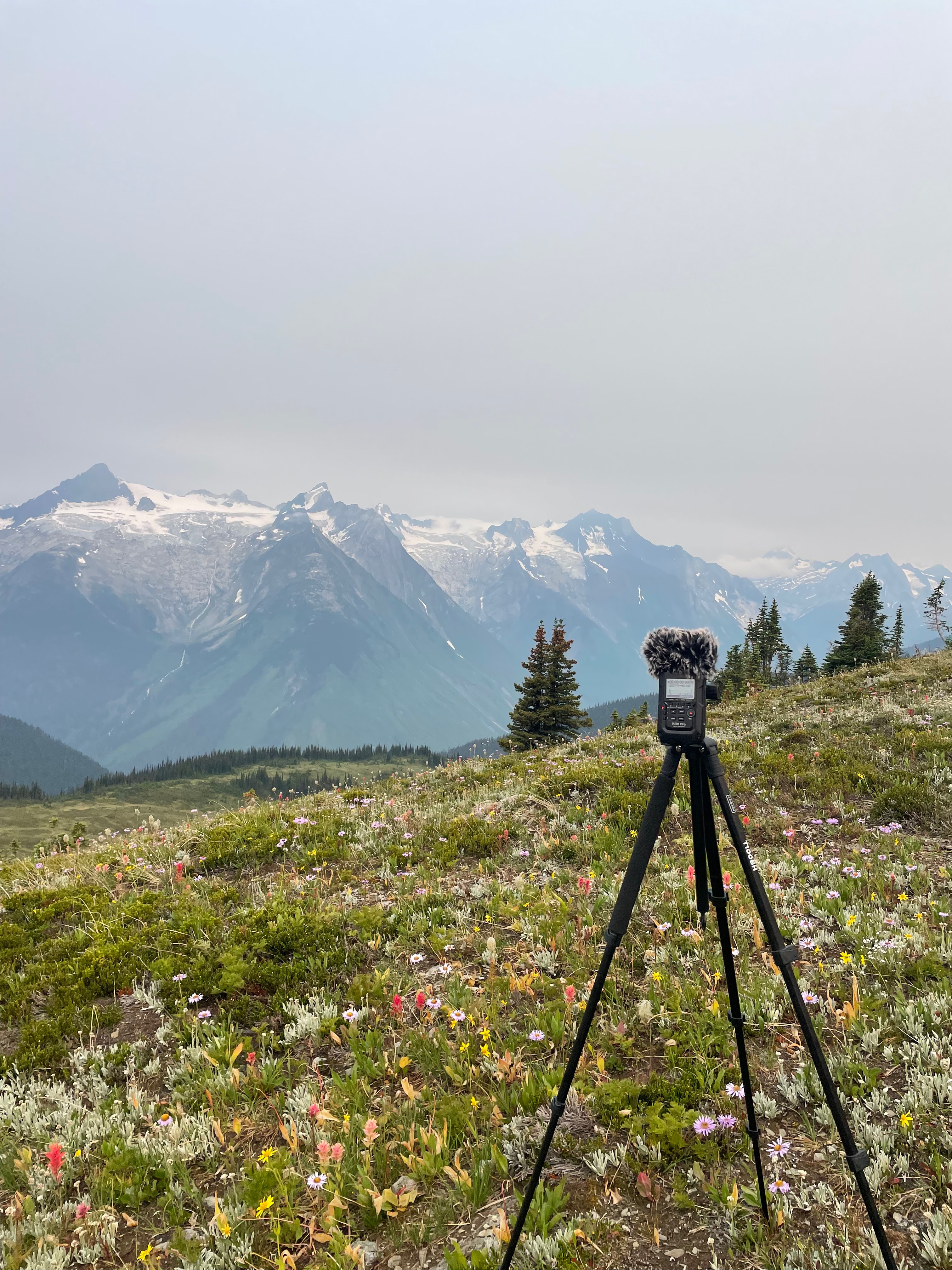
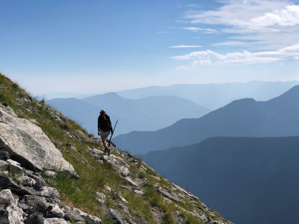
About me
Hi! My name is Kenzie Stevenson. I’m a BC-based geospatial and conservation professional. Welcome to my portfolio.
I am currently completing the Master of Geomatics for Environmental Management program with the UBC Faculty of Forestry and Environmental Sustainability.
I’m particularly interested in using GIS to analyze data and support sustainable environmental decision making.
Current projects
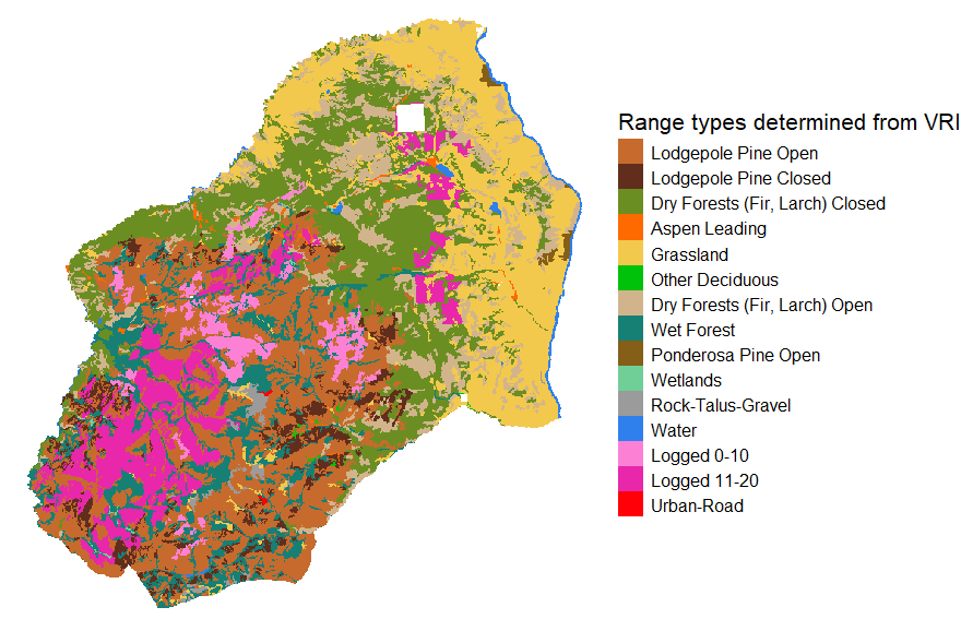
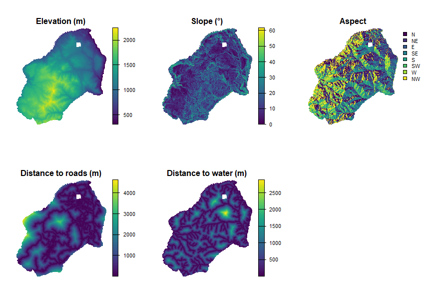
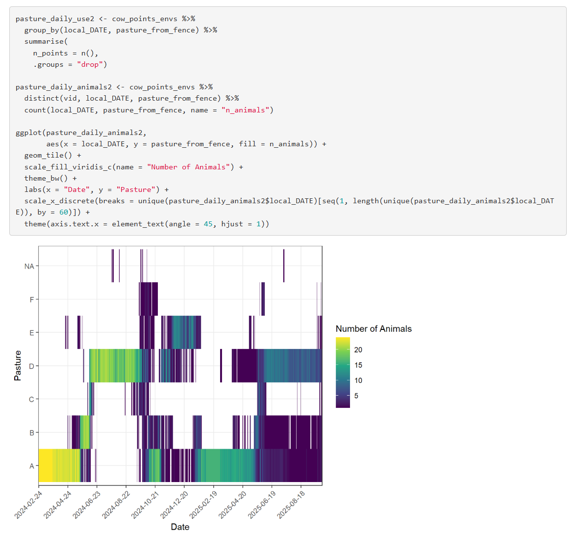
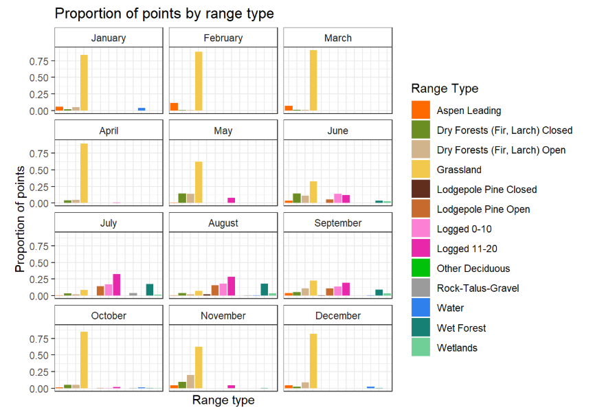
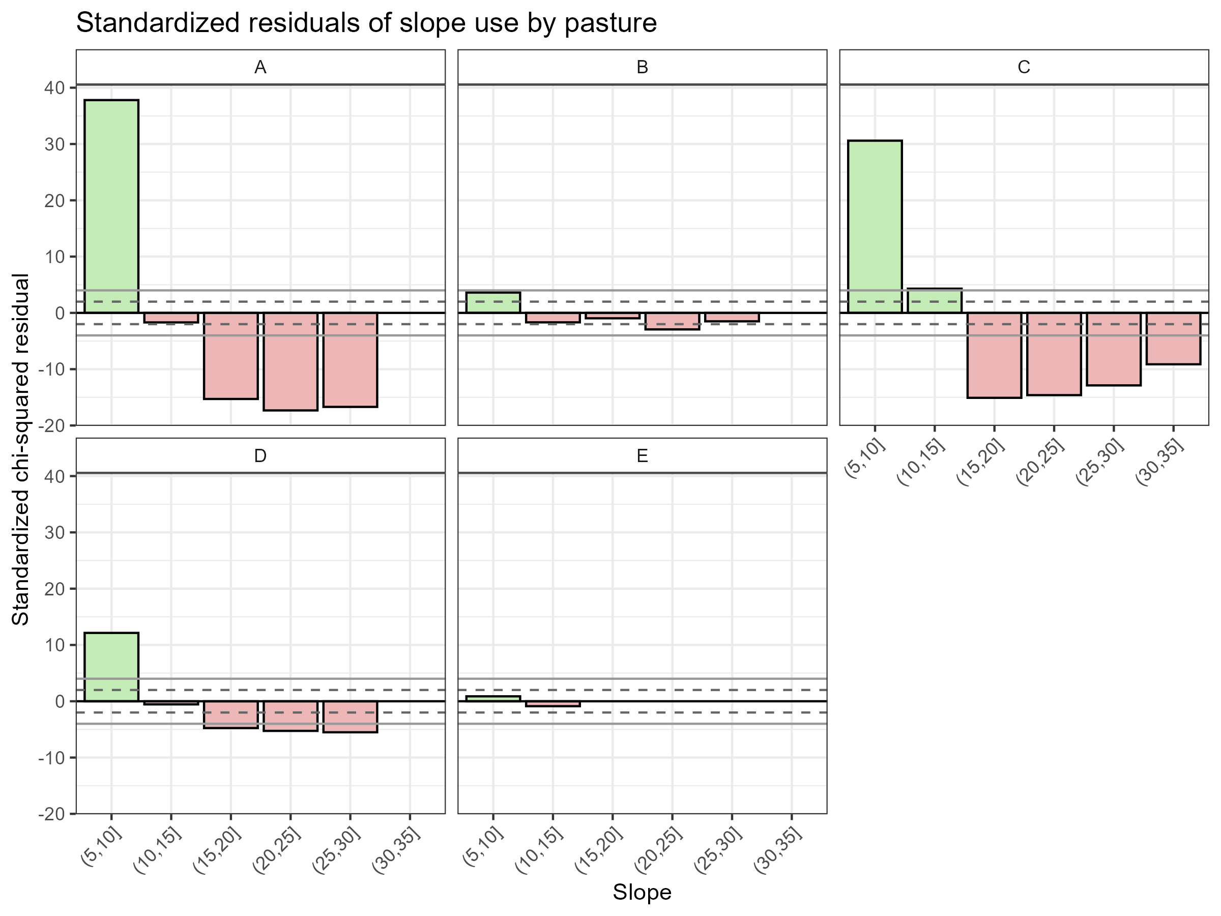
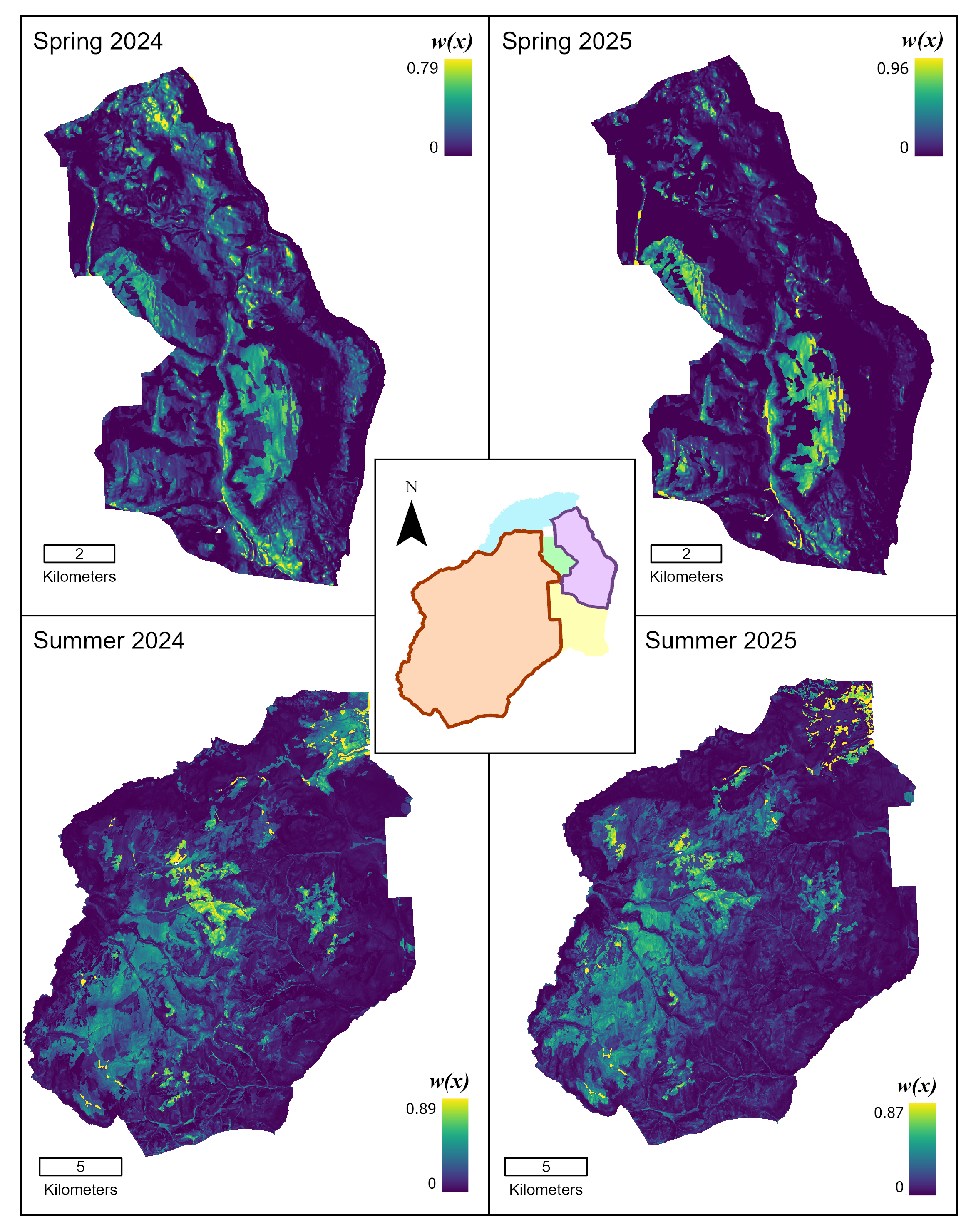
I’m currently working on an analysis of cattle GPS locations to investigate cattle utilization of tenure land in collaboration with the BC Ministry of Forests Range Branch. I’ve investigated correlations between observed cattle use and environmental variables and developed four models (Resource Selection Functions) to determine probability of use across the landscape in four different study periods.
Throughout my experience in the MGEM program, I’ve developed many skills in geospatial data management and analysis. Some highlights have included habitat and terrain analyses, stream assessments, forest-based applications of LiDAR, and image-based remote sensing.
I’ve also thoroughly enjoyed developing my R, Python and SQL scripting skills, and working to produce robust and repeatable workflows. I’ve gained familiarity with many packages, including sf, terra, lidR, dplyr, ggplot, arcpy, numpy, matplotlib and rasterio.
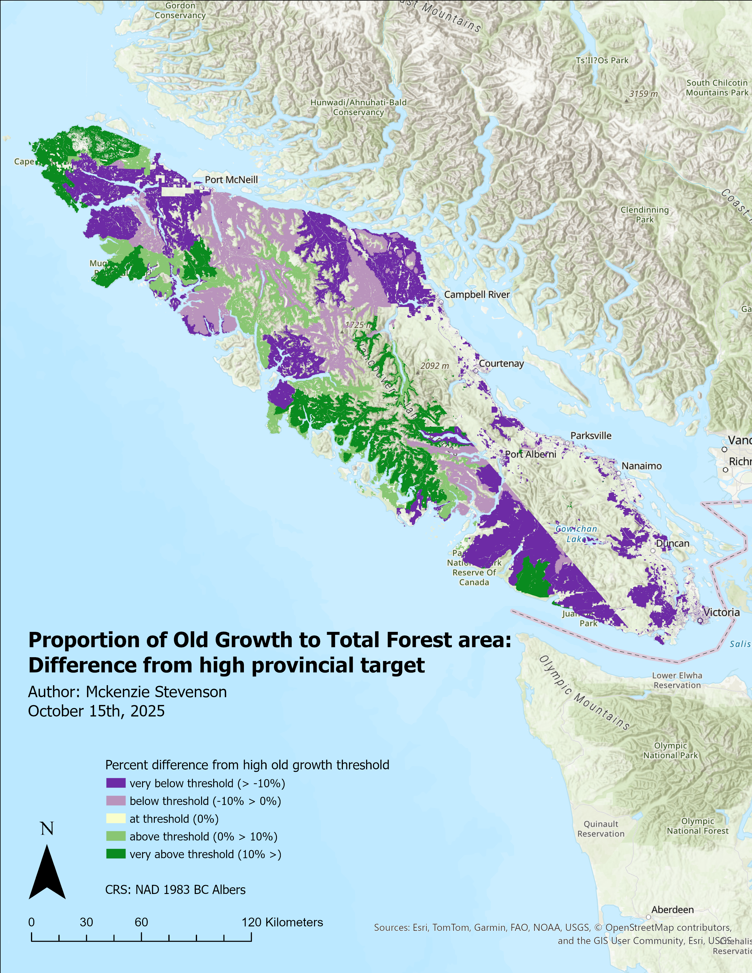
An analysis of old growth forest area on Vancouver Island, derived from VRI data 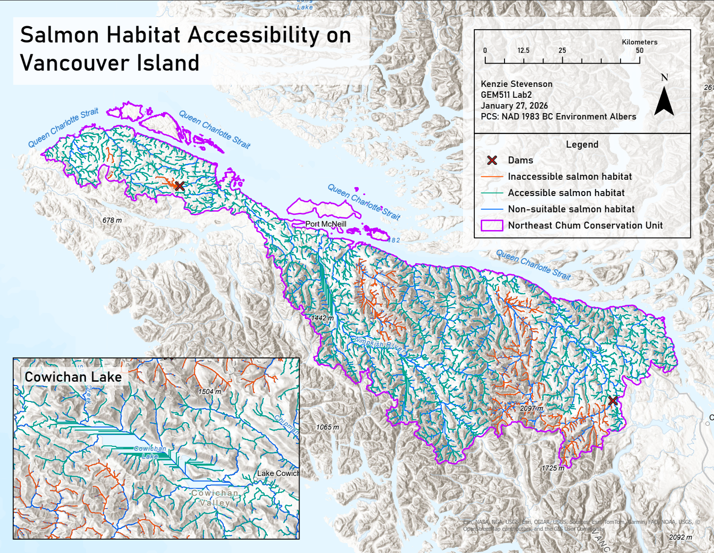
An analysis of suitable salmon habitat in the Northeastern Chum conservation unit on Vancouver Island 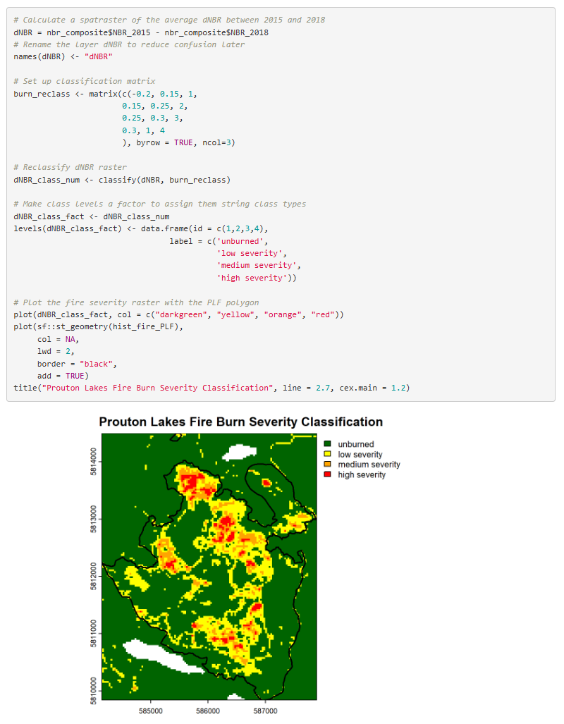
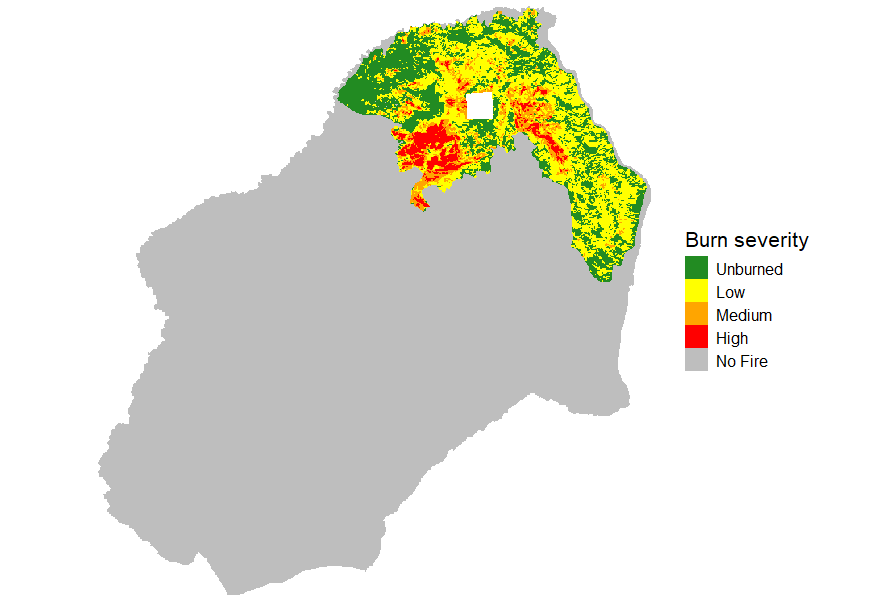
A snippet of R code and resulting plot assessing burn severity from composite satellite imagery 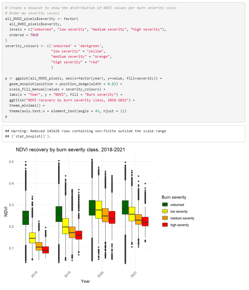
A snippet of R code and resulting plot assessing burn severity from composite satellite imagery 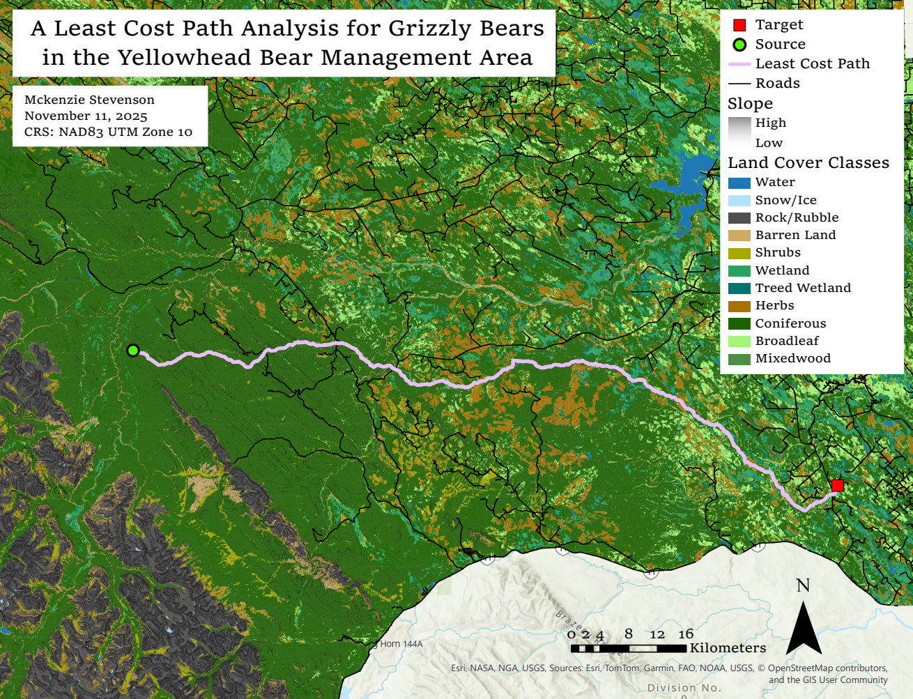
Output from a least cost path analysis for grizzly bears in the Yellowhead Bear Management Area 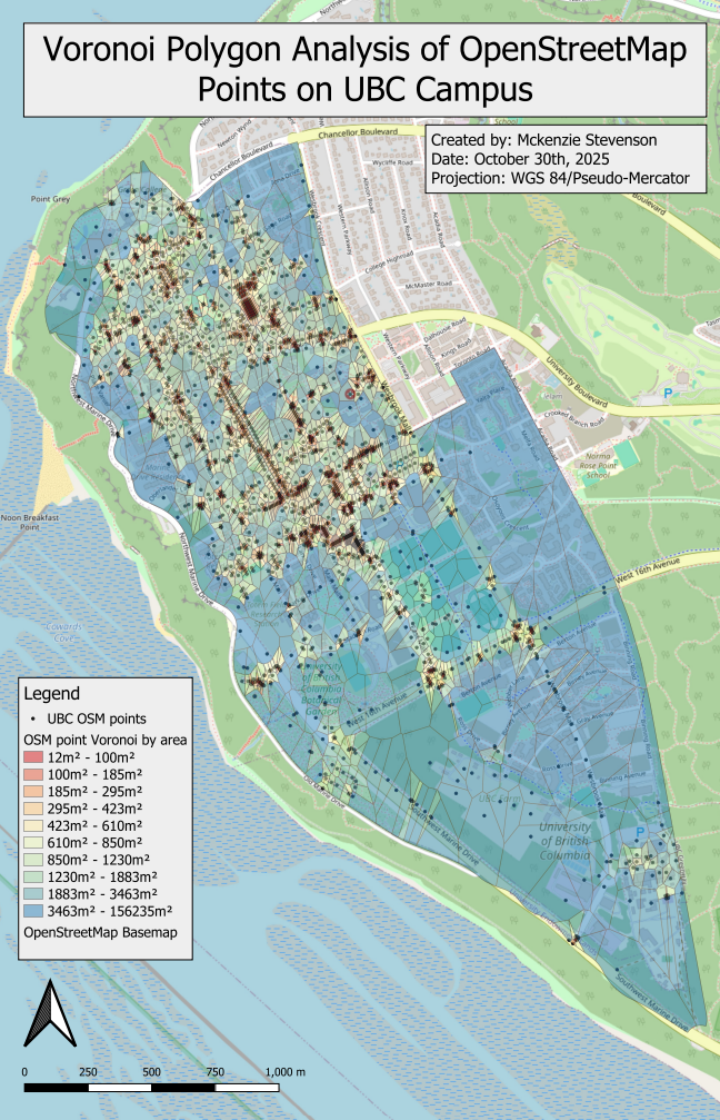
An analysis of OpenStreetMap point data density on UBC campus 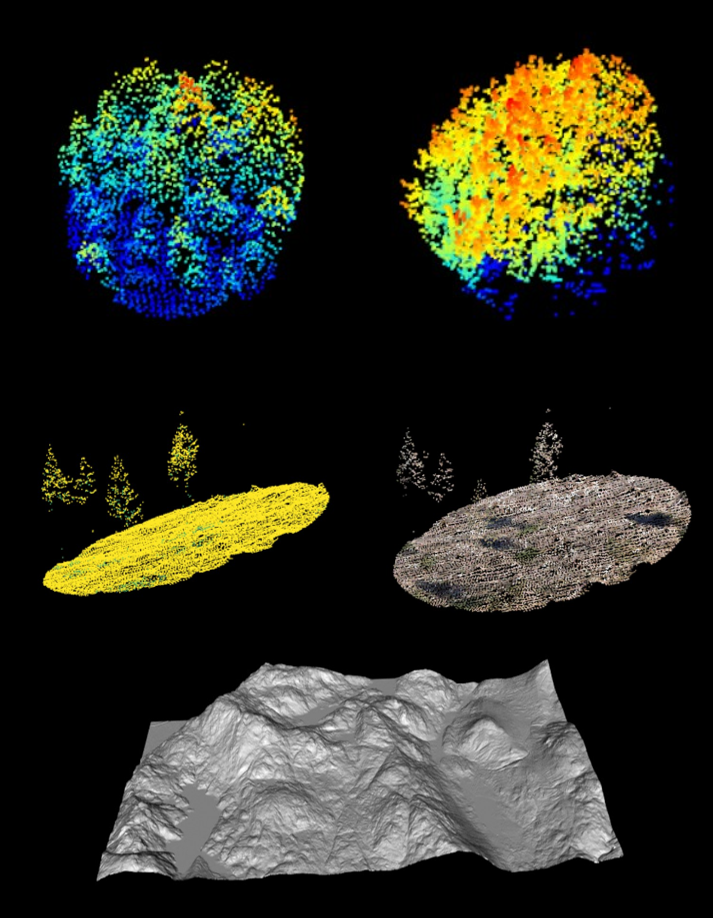
Data outputs from a LiDAR-based analysis, including point clouds of forest plots, and a DEM 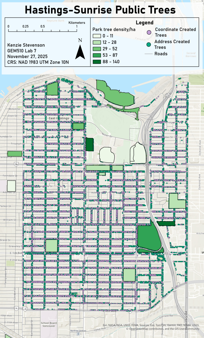
An analysis of geocoded trees of the Hastings-Sunrise neighbourhood 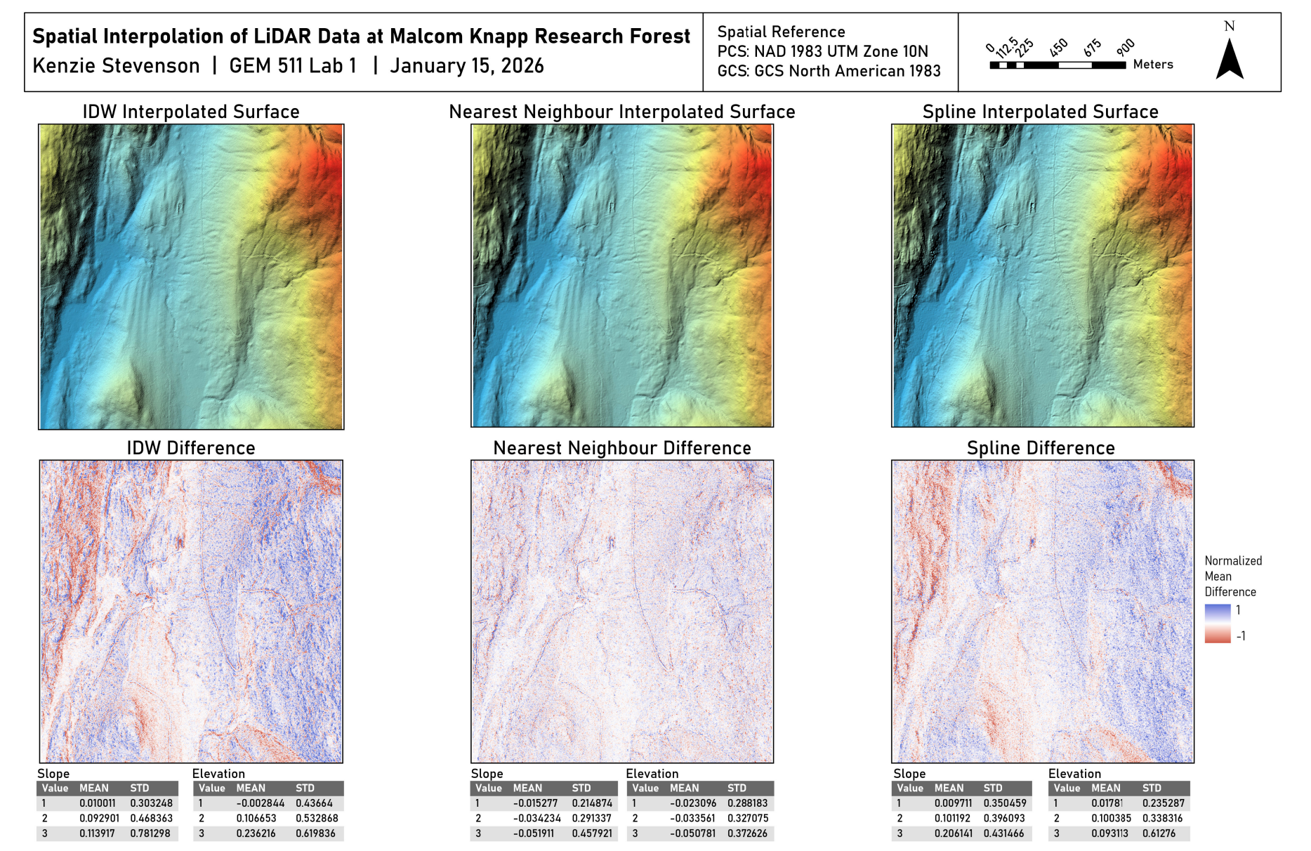
An assessment of spatial interpolation methods 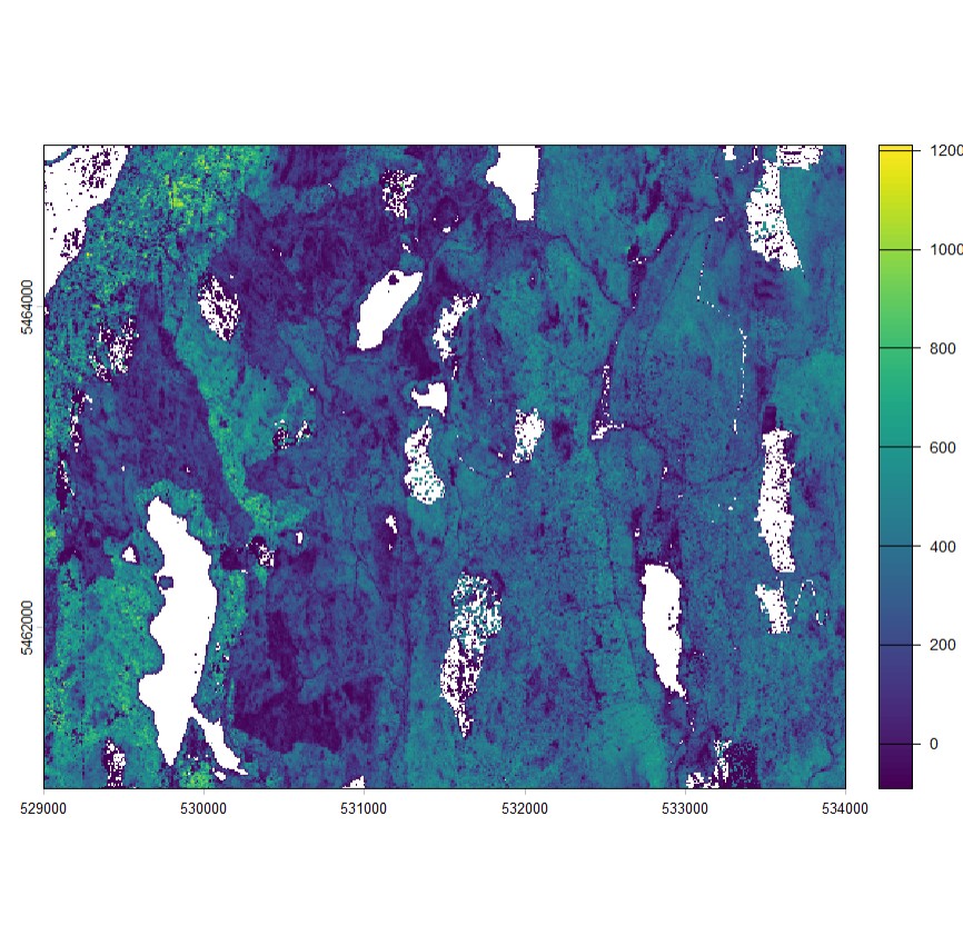
Modelled surface of above ground biomass, calculated from available study site data and model built using a forward stepwise model selection.
Further subjects have included professional communication and working with diverse knowledge systems in natural resource management. I’m looking forward to implementing the skills learned in through these discussions to support sustainable resource management decisions and building strong teams.
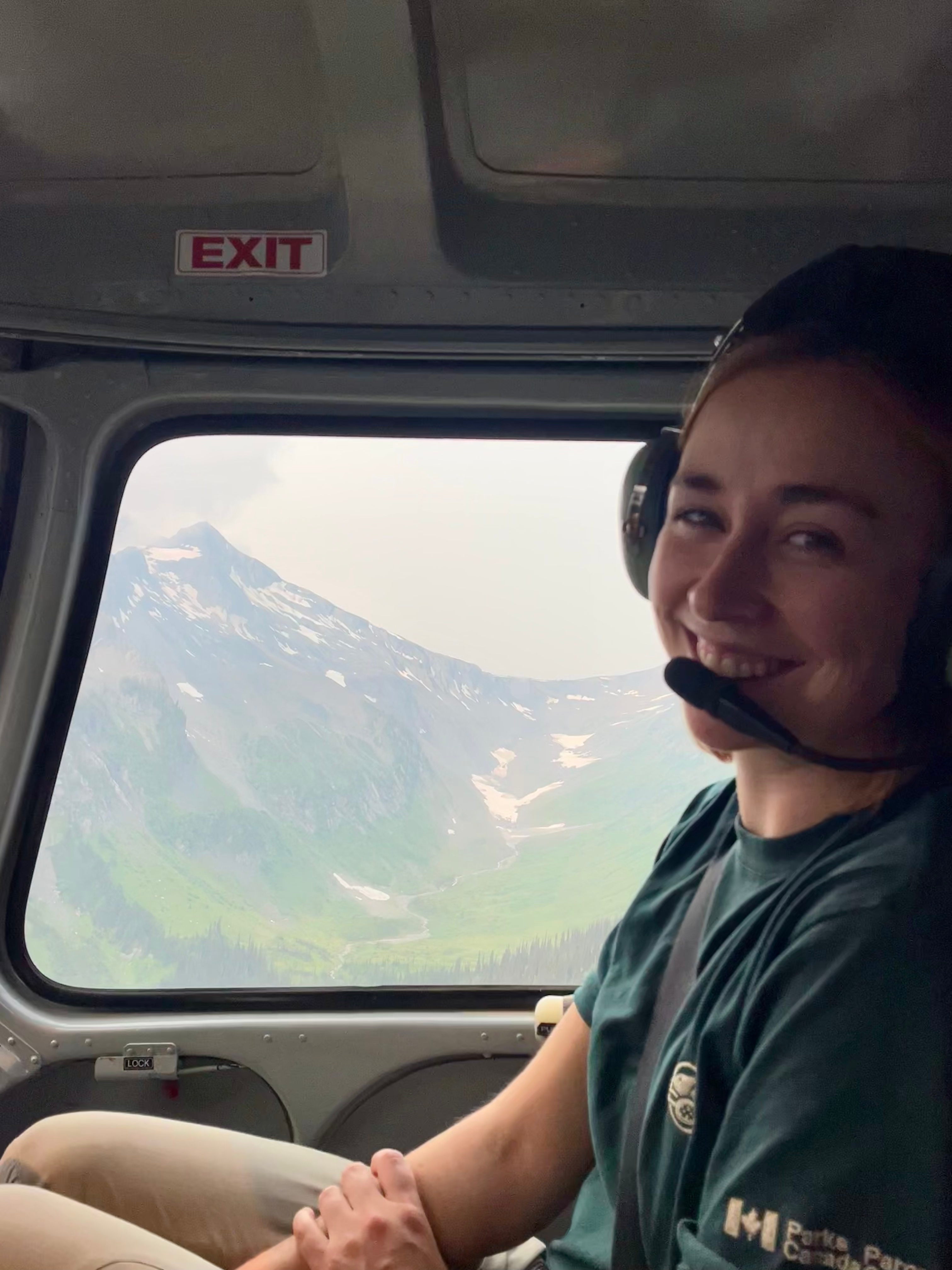
Past work
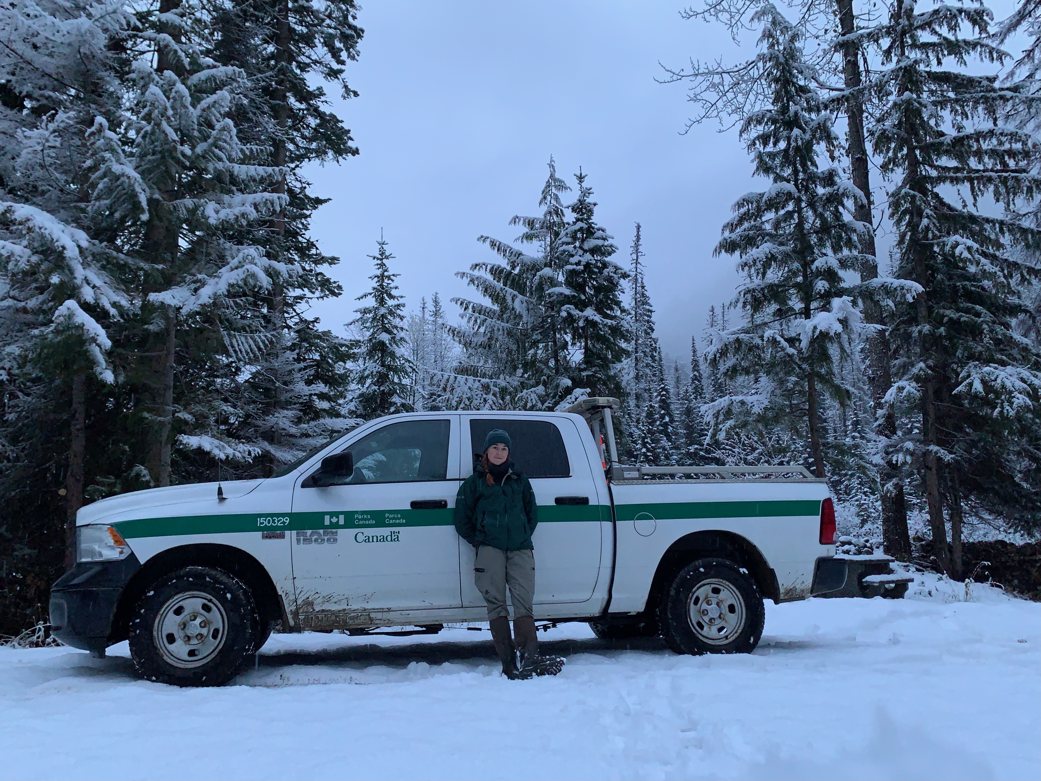
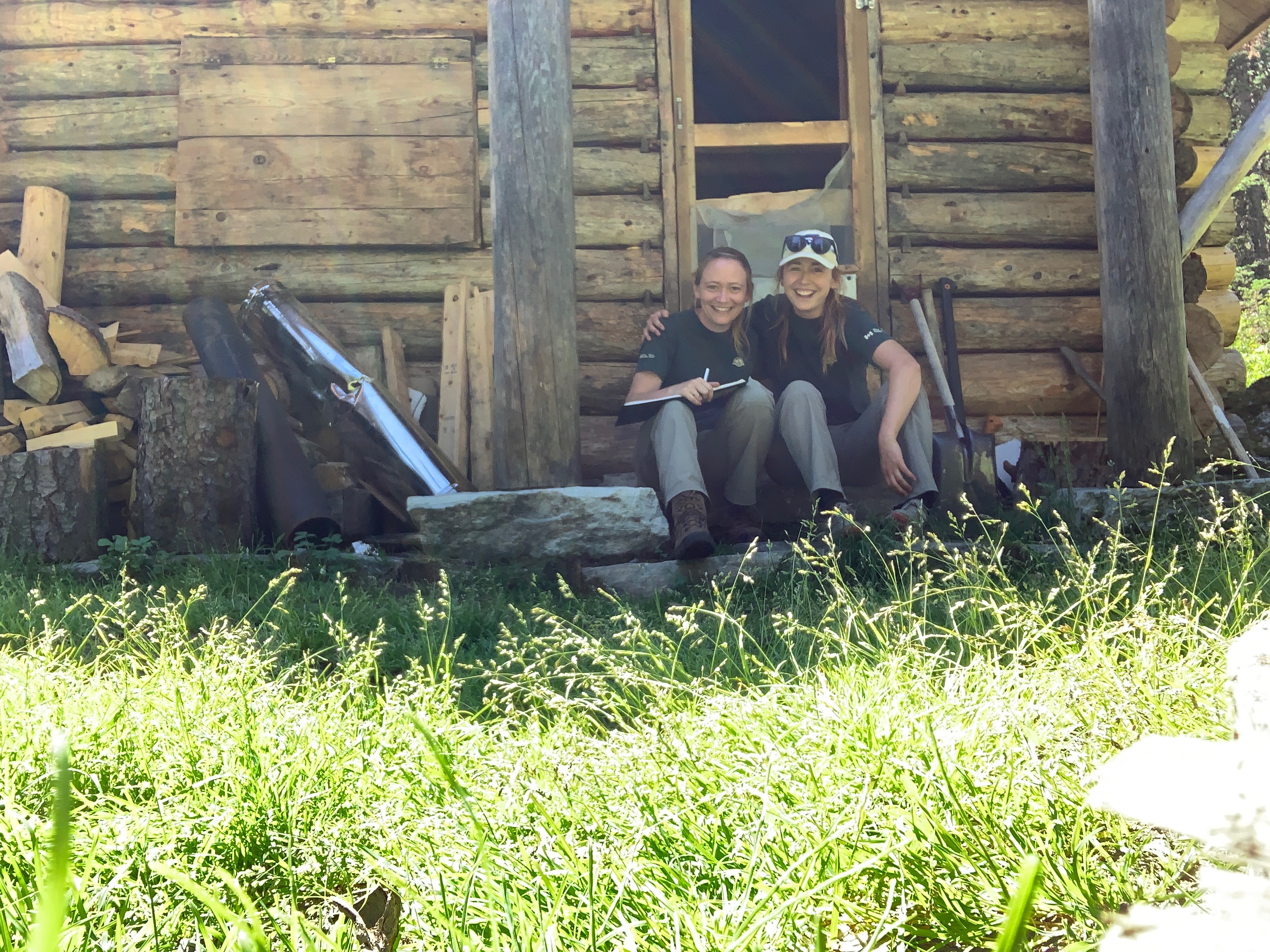
In my professional life, I’ve worked for Parks Canada since 2019. I’ve worn many hats – starting in outreach, before moving into ecological monitoring, impact assessment, back to ecological monitoring, and most recently, human wildlife coexistence. Each role has provided new opportunities for me to explore a new facet of protected area management. A throughline in all my positions has been the interface between humans and wildlife in the natural environment – a topic rife with geospatial implications.
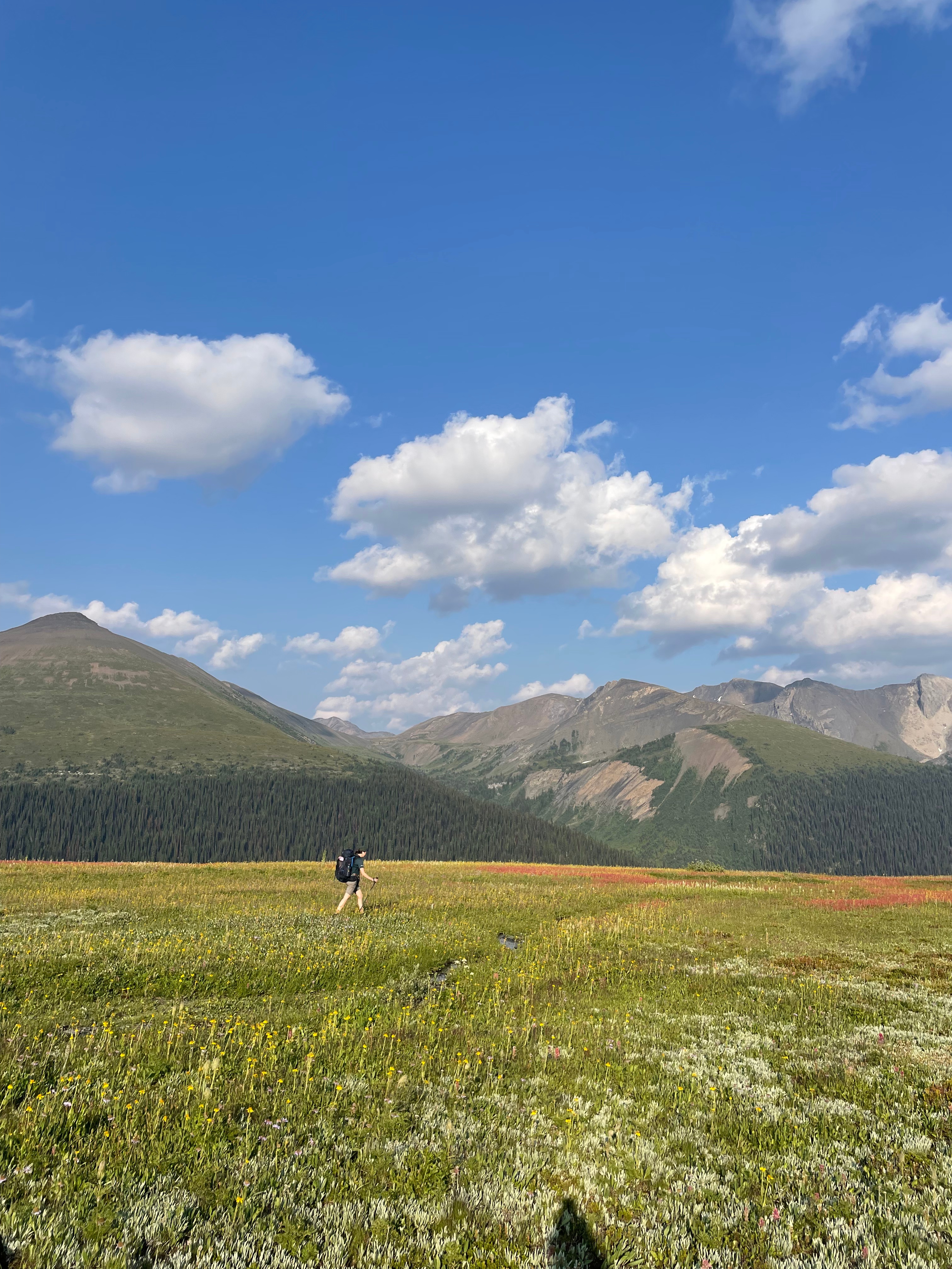
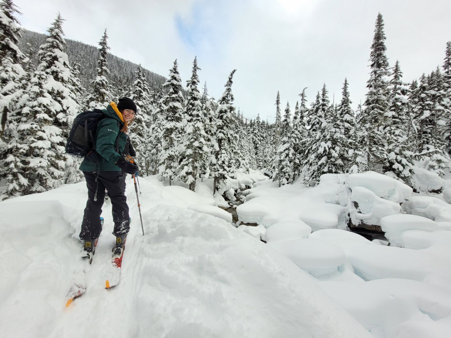
My interests
There is no shortage of topics I’d like to spend my career exploring, but here are a few of particular interest to me.
Topical
- Habitat change
- Spatial ecology
- Road ecology
- Human wildlife coexistence
- Supporting Indigenous-led conservation
- Parks and protected areas
- Recreation
Technical
- Habitat suitability and movement modelling
- Species at Risk assessment
- Applications of R in GIS
- Spatial statistics
- Science communication and story telling through maps
Outside of my technical and career pursuits, I love to spend my time hiking, biking, skiing, listening to podcasts, and trying to perfect my latte art (distinctly not one of my skills).
Resume
Natural Resource Experience
Parks Canada Agency – Resource Management Officer I
Human Wildlife Coexistence – Mount Revelstoke and Glacier National Parks
May 2025 – August 2025, Rogers Pass BC
- Led mountain goat monitoring and collision mitigation efforts, managing deployment and data collection of 16 remote camera traps across four monitoring sites.
- Managed high pressure human-wildlife conflict situations, including bear-visitor encounters, roadside interventions, and attractant control, ensuring public and wildlife safety.
- Conducted GPS telemetry tracking of a collared grizzly bear using Inventa and VHF telemetry systems to support monitoring and management objectives.
- Maintained operational readiness through detailed reporting, equipment upkeep, and adherence to safety protocols; contributed to ecological integrity monitoring field objectives.
Ecological Integrity Monitoring – Mount Revelstoke and Glacier National Parks
May 2024 – April 2025, Rogers Pass BC
- Coordinated and undertook ecological field operations for acoustic bird monitoring and passive bat recording, preparing spatial resources, managing logistics and equipment, mentoring student employees, and upholding safety protocols.
- Collected and analyzed long-term ecological datasets; assessed bird species population trends using R, ArcGIS, and Access while maintaining rigorous data quality control and digital data management standards; advised on new sampling locations to support study strength.
- Reported project outcomes, produced maps for technical reports using ArcGIS.
- Prepared and tracked data for submission to open data portals in accordance with open data program standards.
Environmental Surveillance – Mount Revelstoke and Glacier National Parks
May 2021 – March 2024, seasonal indeterminate, Rogers Pass BC
- Ensured environmental compliance and impact mitigation by preparing site maps and technical reports, conducting surveillance, and collaborating with contractors and park staff to meet regulatory and contractual requirements.
- Led operational response initiatives, coordinating spill response efforts, delivering training; provided environmental guidance to staff across field unit functions.
- Managed roadside wildlife camera trap program, overseeing logistics, data collection and analysis; supported ecological integrity monitoring field work.
- Installed stream temperature data loggers and conducted water quality sampling, ensuring accurate data collection.
Species at Risk – Gulf Islands National Park Reserve
January 2023 – March 2023, term, remote
- Synthesized program data and reporting for the Multi Species Action Plan Implementation Report, ensuring accurate, comprehensive documentation of actions and progress.
- Interpreted species-at-risk legislation and ecological scientific literature to inform recovery planning efforts.
Ecological Integrity Monitoring – Pukaskwa National Park
January 2021 – March 2021, term, remote
- Prepared season-end summary reports and operational guidance documentation to inform program planning and management decisions.
- Analyzed NDVI-derived forest productivity data and produced a technical report to support ecological integrity monitoring objectives.
Parks Canada Agency – Summer Student
Ecological Integrity Monitoring – Mount Revelstoke and Glacier National Parks
May – August 2019, Rogers Pass BC
- Conducted extensive remote field data collection to support the delivery of the ecological integrity monitoring program, including surveying wetlands, deploying acoustic recording units and remote cameras.
- Planned logistics and scheduling of field objectives; analyzed and organized data according to protocols.
Education
Candidate for Master of Geomatics for Environmental Management (MGEM), 2025-2026
University of British Columbia, Department of Forestry
- Relevant course topics include analytical and quantitative skills in GIS, spatial data analysis and statistics, programming, remote sensing, and image processing.
- Produced cattle land use model (Resource Selection Function) as capstone project in partnership with the British Columbia Ministry of Forests.
- Developed strong skills in geospatial data management and analysis in various programs including ArcGIS, QGIS, ENVI and pgAdmin, and programming languages including R, Python and SQL.
Bachelor of Science in Environmental Sciences (BSc. ENV), 2016-2020
University of Guelph, Major in Environment and Resource Management
- Relevant course topics include GIS and Spatial Analysis, Ecology, and Management of the Biophysical Environment.
- Completed the Clayoquot Sound Field Semester program with the University of Victoria, strengthening field work skills such as project planning, data collection and analysis using RTK and total stations, and species identification.
Volunteer Experience
- Sea-to-Sky Mammal Monitoring Project Volunteer (September-November 2020) – Identified, entered and managed data on coastal wildlife species from camera trap images.
- Wolverine Watch Field Work Volunteer (June 2019) – Assisted in servicing helicopter access remote camera wolverine monitoring sites in the Columbia mountain region.
- Wetland Stewards for Clayoquot and Barkley Sounds (February-April 2019) – Conducted amphibian surveying of ponds and wetlands; produced a report summarizing data and suggestions for land use decision makers.
Technical Skills
- Geospatial software: ArcGIS Pro and Online, QGIS, ENVI and Avenza
- Geospatial analysis: imagery based remote sensing analysis, raster processing, LiDAR/point cloud management and analysis, habitat suitability mapping
- Scripting languages: R (terra, sf, tidyr, ggplot, lidR), Python (arcpy, rasterio, matplot) and SQL
- Database management: PostgreSQL (pgAdmin), Microsoft Access, ESRI geodatabases
- Field and monitoring equipment: GPS units, remote cameras, acoustic recording units, VHF telemetry equipment, flow meters
